No products in the cart.
GIS Dashboards 101: Simplifying Fiber Construction
Home GIS Dashboards 101: Simplifying Fiber Construction
- Home
- Resource Hub
- Millennium Blog
- GIS Dashboards 101: Simplifying Fiber Construction
GIS DASHBOARDS 101
Simplifying Fiber Construction
Winning the FTTH race comes down to finding fiber construction efficiencies that accelerate your time to market. However, designing, constructing, and managing a fiber optic network is demanding. Challenges include coordinating with key stakeholders, navigating regulatory requirements, meeting funding requirements, and finding ways to reduce fiber construction costs. You may be enthusiastic about starting an engineering project only to get overwhelmed with conflicting data as you progress in your project planning. It’s not unheard of to see a mismatch between county or city data and census data. In these types of instances, you may be unable to calculate your take rate and make-ready successfully. If enough data inaccuracies add up, you’ll face a significant disparity between your estimated and actual project costs, undermining your anticipated ROI. Millennium Engineering can solve these and other barriers to create an effective fiber construction roadmap with a clear picture of your ROI and give you cutting-edge GIS tools to expedite the growth of your broadband business.
GIS in Fiber Construction
Geographic Information Systems (GIS) combine location-based data with descriptive information to provide fiber network builders with straightforward, actionable insights. This technology can pinpoint existing infrastructure, such as water pipes, giving you a detailed visualization of your fiber construction project before any onsite work begins. You can avoid costly redesigns by mapping out project obstacles ahead of time. Millennium Engineering is adept at leveraging Esri ArcGIS — the industry’s leading GIS mapping software — to streamline your fiber construction project. Whether you’re stuck mid-project, juggling multiple tasks, or need expert input, Millennium Engineering can step in and take over your network design and planning. The team can also seamlessly migrate your in-house data from Google Maps, Google Earth data, another outdated mapping software, or just a bunch of Excel docs into Esri’s ArcGIS platform for better data management.
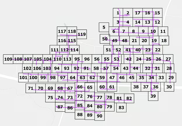
After approving your design, Millennium Engineering can further optimize your fiber construction by setting up real-time project tracking through customized interactive GIS dashboards. With a continuous feedback loop, you can make informed decisions that keep your project on track. Given the demands of funding programs like BEAD, resource allocation is essential for project success. Tailored Millennium GIS dashboards offer a powerful, intuitive project management solution for easily assessing performance and making timely material purchases, staff scheduling, and more. These GIS dashboards also facilitate compliance management for grant funding and permitting by helping project managers track permit statuses, funding requirements, and their respective deadlines.
Finding Efficiencies During Fiber Construction
Challenges such as labor shortages, material delays, and resource deployment can hinder fiber network construction. However, access to reliable, real-time field data available in Millennium GIS dashboards can overcome these obstacles.
GIS dashboards facilitate:
- Efficient labor management and oversight
- Streamlined workflow delegation
- Comprehensive project reporting
Integrating field maps with GIS dashboards can also speed up the as-built process. Project managers can log live fiber footage and mark completed sections for expedited invoicing and project reporting. The potential return on investment of incorporating GIS in the construction process is significant, particularly in an environment that prioritizes speed and efficient labor management.
Designing & Planning Stage

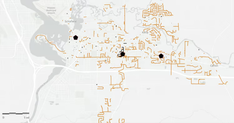
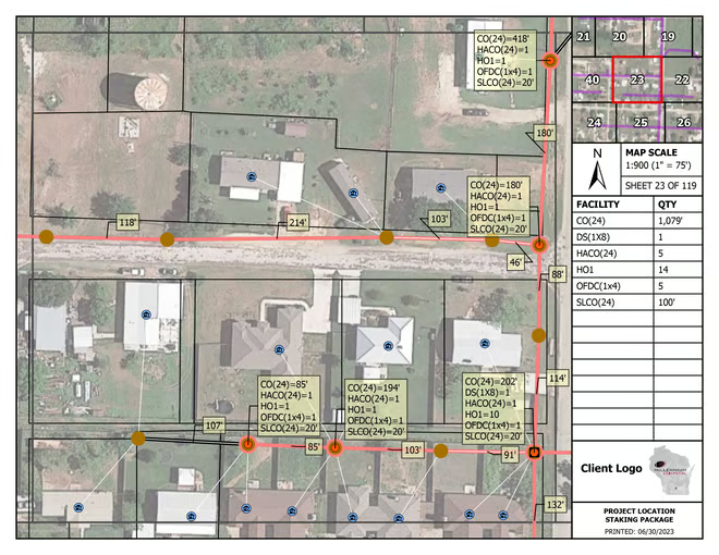
Using GIS to design and plan your fiber construction sets your project up for success from the start. GIS dashboards provide customized maps that give you a detailed understanding of your service area, allowing you to build your network efficiently. GIS helps you choose both a High-Level Design (HLD) for your network that captures your overall network architecture and a Low-Level Design (LLD) that gives you nitty gritty technical specifications for managing your fiber construction project like splicing diagrams that show fiber routes and splitter locations. Using GIS as both a design tool and asset management platform, broadband businesses can provide efficiencies that increase ROI.
Millennium
GIS Dashboards for Fiber Construction & Management
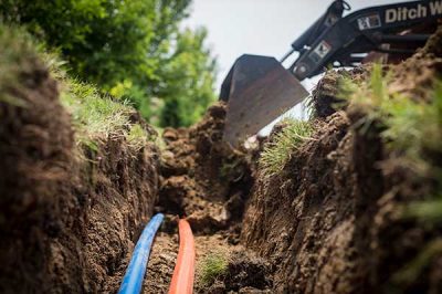
GIS dashboards are the ultimate fiber construction tracking tool through all phases of fiber network engineering and project implementation. Millennium Engineering can set up GIS dashboards for your build, including engineering tracking, bill of materials (BOM) tracking, permit tracking, construction tracking, and fiber splicing management. Not only are GIS dashboards user-friendly, but they’re also highly customizable to your fiber construction needs. These dashboards are also compatible with Esri’s ArcGIS Field Maps app, which works on smartphones or tablets, giving you the power to connect your back office people with real-time updates from your field crew so you can find construction efficiencies that save money and get you to market faster.
Splicing Management Dashboard
Stay in control of your splicing operations with this dashboard, which gives you live insights into the location and quantity of your network splices. Knowing the required splicing materials can help secure cost-effective bulk purchases from your suppliers.
Construction Tracking Dashboard
Monitor construction progress in real-time and assess whether you’re on track to achieve your ROI milestones. Immediate updates inform you about any geological obstacles your team encounters, allowing you to address issues promptly and prevent delays.
LLD/BOM Dashboard
Anticipate the materials and labor needed for your fiber construction project and identify potential shortages before they happen. As fiber construction progresses, your material staking units update in real-time, enabling you to provide a bill of materials to your distributors for quick quoting.
Empowered With GIS Data for Business Growth
Unlocking the potential of GIS technology in your fiber construction progress can drive success for your business by avoiding expensive mistakes that come from making decisions without all the right data at your fingertips. By partnering with Millennium Engineering to create your fiber design and bespoke GIS dashboards, you’ll experience a powerful way to accelerate your planning and construction workflows. By partnering with Millennium Engineering to centralize business-critical data, you can devote more time to strategic decision-making that supports company health and improves connectivity for unserved and underserved rural communities.

Millennium Engineering takes pride in being a recognized member of ESRI’s Silver Partner Network, highlighting our dedication to having a fully certified technical team accredited with the ESRI Release Ready Specialty. This alliance grants us access to ESRI’s top-tier ARCGIS software, renowned for its robust geolocational mapping and data intelligence capabilities that enhance insight gathering, data monitoring, and precise forecasting. Leveraging ESRI’s sophisticated tools and educational resources, Millennium Engineering consistently brings unmatched intelligence and operational efficiency to every network project.
Contact a Geospatial Expert Today!
- Feasibility Studies & Network Design Plans
- Financing & Grants
- Project Resource Management
- Material Supply & Logistical Planning
- Equipment Leasing & Rentals

